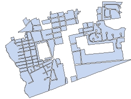
Combines the polygons from the input layer that are within the user specified distance into new polygons. Can be used also to generalize buildings.
Input Dataset
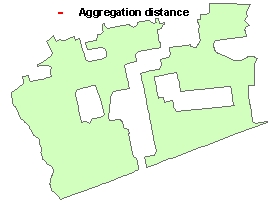
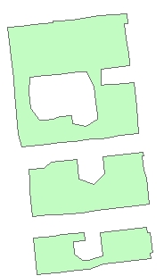
Result (No Minimum area of holes specified)
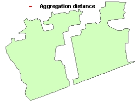
Result (Minimum area of holes specified)
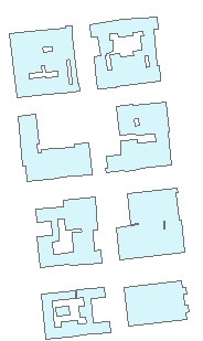
Input Dataset
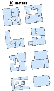
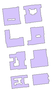
Aggregate distance = 1 meter
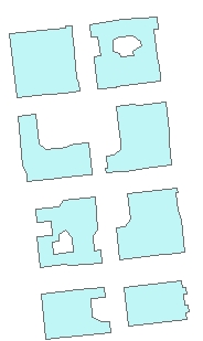
Aggregate distance = 5 meters
Aggregate distance = 10 m
Aggregate distance = 20 m
Parameters
| Expression | Explanation |
|---|---|
| Function Name | AggregatePolygons |
| <input dataset> | A String representing the input layer. Must be of Polygon type. |
| <output dataset> | A String - the full name of the output layer. |
| <Aggregation Distance> | A Double representing the aggregation distance. The polygons that are closer to each other than this distance will be combined. |
| {Area Tolerance} | A Double representing the minimum area of holes to be preserved. All holes with area less than this tolerance will be removed. |
ETGWPath used in the table below is the full path to ETGWRun.exe (E.G. "C:\Program Files\ETSpatial Techniques\ETGeo Wizards\ETGWRun.exe")
| Language | Syntax |
|---|---|
| Python | subprocess.call([ETGWPath, "AggregatePolygons", "input dataset", "output dataset", "Aggregation Distance", "Area Tolerance"]) |
| .NET using ETGWRun.exe | StartInfo.FileName = ETGWPath StartInfo.Arguments = "AggregatePolygons" "input dataset" "output dataset" "Aggregation Distance" "Area Tolerance" |
| .NET using ETGWOutX.dll | AggregatePolygons(input dataset, output dataset, Aggregation Distance, Area Tolerance) |
| ArcPy | arcpy.AggregatePolygons(input dataset, output dataset, "Aggregation Distance", "Area Tolerance") |
Notes:
<> - required parameter
{} - optional parameter
The argument separator for StartInfo.Arguments is space. If a string might contain a space, you need to double quote it.