Buffers a group of neighboring polygons in such a way that:
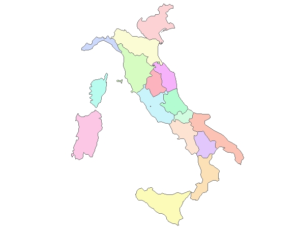
Input polygons
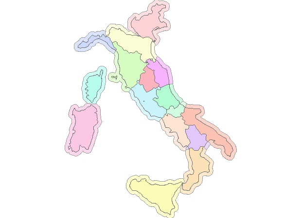
Output Buffers - Merge Option = False (not selected)

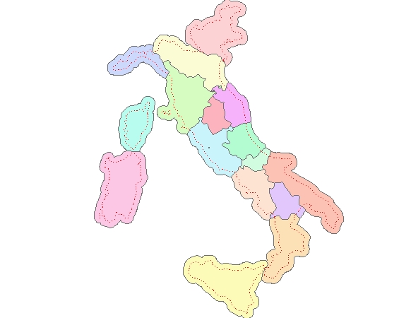
Output Buffers - Merge Option = False (not selected) overlaid with the original polygons
Output Buffers - Merge Option = True ( selected). The red polyline is the outline of the original polygons.
Parameters
| Expression | Explanation |
|---|---|
| Function Name | BufferPolygonsNoOverlaps |
| <input dataset> | A String representing the input layer. Must be of polygon type. |
| <output dataset> | A String - the full name of the output layer. |
| <Buffer Distance> | A Double. The buffer distance to be used. |
| <ID Field> | A String. The name of the field in the input dataset to be used. |
| <Merge> | A Boolean. Indicating whether the buffers to be merged to the original polygons. |
| {Precision} | A string indicating the precision of the output. Valid values - "Normal", "Medium", "High". Default value - "Normal" |
ETGWPath used in the table below is the full path to ETGWRun.exe (E.G. "C:\Program Files\ETSpatial Techniques\ETGeo Wizards\ETGWRun.exe")
| Language | Syntax |
|---|---|
| Python | subprocess.call([ETGWPath, "BufferPolygonsNoOverlaps", "input dataset", "output dataset", "Buffer Distance", "ID Field", "Merge", "Precision"]) |
| .NET using ETGWRun.exe | StartInfo.FileName = ETGWPath StartInfo.Arguments = "BufferPolygonsNoOverlaps" "input dataset" "output dataset" "Buffer Distance" "ID Field" "Merge" "Precision" |
| .NET using ETGWOutX.dll | BufferPolygonsNoOverlaps(input dataset, output dataset, Buffer Distance, ID Field, Merge", Precision") |
| ArcPy | arcpy.BufferPolygonsNoOverlaps(input dataset, output dataset, "Buffer Distance" , "ID Field", "Merge", "Precision") |
Notes:
<> - required parameter
{} - optional parameter
The argument separator for StartInfo.Arguments is space. If a string might contain a space, you need to double quote it.