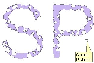
Delineates cluster polygon for the input points based on user specified cluster distance.
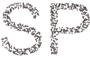
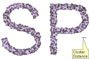
Source Points
Cluster Polygons 1
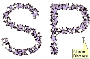
Cluster Polygons 1 overlaid with the source points
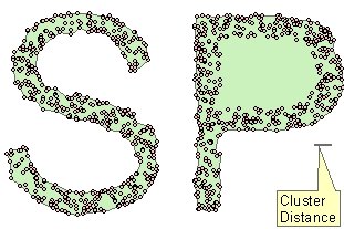
Cluster Polygons 2
Cluster Polygons 2 overlaid with the source points
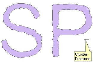
Cluster Polygons 3 (No Holes option selected)

Cluster Polygons 3 overlaid with the source point
Parameters
| Expression | Explanation |
|---|---|
| Function Name | PointsToClusterPolygonsS |
| <input dataset> | A String representing the input layer. Must be of Point type. |
| <output dataset> | A String - the full name of the output layer. |
| <Cluster Tolearance> | A Double representing the Cluster Tolearance( in the units of the spatial reference of the input dataset). |
| {Remove Holes} | A Boolean indicating whether the function to remove the holes created during the interpolation. |
ETGWPath used in the table below is the full path to ETGWRun.exe (E.G. "C:\Program Files\ETSpatial Techniques\ETGeo Wizards\ETGWRun.exe")
| Language | Syntax |
|---|---|
| Python | subprocess.call([ETGWPath, "PointsToClusterPolygonsS", "input dataset", "output dataset", "Cluster Tolearance", "Remove Holes"]) |
| .NET using ETGWRun.exe | StartInfo.FileName = ETGWPath StartInfo.Arguments = "PointsToClusterPolygonsS" "input dataset" "output dataset" "Cluster Tolearance" "Remove Holes" |
| .NET using ETGWOutX.dll | PointsToClusterPolygonsS(input dataset, output dataset, Cluster Tolearance, Remove Holes) |
| ArcPy | arcpy.PointsToClusterPolygonsS(input dataset, output dataset, "Cluster Tolearance", "Remove Holes") |
Notes:
<> - required parameter
{} - optional parameter
The argument separator for StartInfo.Arguments is space. If a string might contain a space, you need to double quote it.