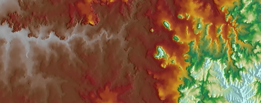
Recalculates the values of the cells of the input raster in such a way that the cell with the lowest value in the
input receives the value of the highest cell and vice versa.
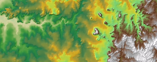
If the raster represents a terrain, the valleys become ridges and the ridges
- valleys.
Input raster.
Inverted raster.
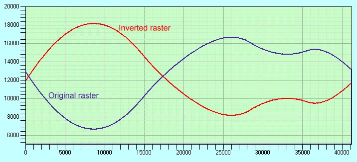
Cross sectional profile of the input and output rasters.
Parameters
| Expression | Explanation |
|---|---|
| Function Name | InvertRaster |
| <input raster> | A String representing the input raster dataset. |
| <output raster> | A String - the full name of the output raster. |
ETSPath used in the table below is the full path to ETSRun.exe (E.G. "C:\Program Files\ETSpatial Techniques\ETSurface\ETSRun.exe")
| Language | Syntax |
|---|---|
| Python | subprocess.call([ETSPath, "InvertRaster", "input raster", "output raster"]) |
| .NET using ETSRun.exe | StartInfo.FileName = ETSPath StartInfo.Arguments = "InvertRaster" "input raster" "output raster" |
| .NET using ETSOutX.dll | InvertRaster(input raster, output raster) |
| ArcPy | arcpy.InvertRaster("input raster", "output raster") |
Notes:
<> - required parameter
{} - optional parameter
The argument separator for StartInfo.Arguments is space. If a string might contain a space, you need to double quote it.