Generates a Flow Direction raster in
which each cells represents the direction of flow for this cell in the DEM
using the D-infinity method.
Inputs:
Outputs:
- A Floating raster representing the Flow Direction according to the
D-infinity (Deterministic Infinity) method.
Notes:
- The D-infinity method was suggested by Tarboton (1997). In it Flow Direction is defined
as the angle of the steepest descent determined by analysis of 8 triangular facets formed by
the 3x3 cell neighborhood.
- The flow direction values are in Decimal Degrees from 0 to 360.0.
The value of 0.0 indicates an outlet and all other values represent the
direction of flow starting from North in clockwise direction.
- For example a value of 90 indicates flow to the East and a value of
225 - flow to South West.
- The D-infinity method allows flow divergence - the flow
from a cell will either go to one or two of the neighboring cells.
This is a better representation of water flow on divergent slopes.
- See Hydrological functions for more information
on the hydrological functionality.
- Supported raster formats are File Geodatabase raster, Personal Geodatabase
raster and file based raster formats (ESRI GRID, Erdas Imagine and
TIFF).
- For file based rasters initially the name of the output raster
defines the raster format
- no extension specified - ESRI binary GRID
- .img extension (for example raster1.img) -
ERDAS IMAGINE image.
- .tif extension (for example raster1.tif -
Tagged Image File Format (TIFF) image.
- The initial output raster format can be
changed by selecting the desired output in the dialog.
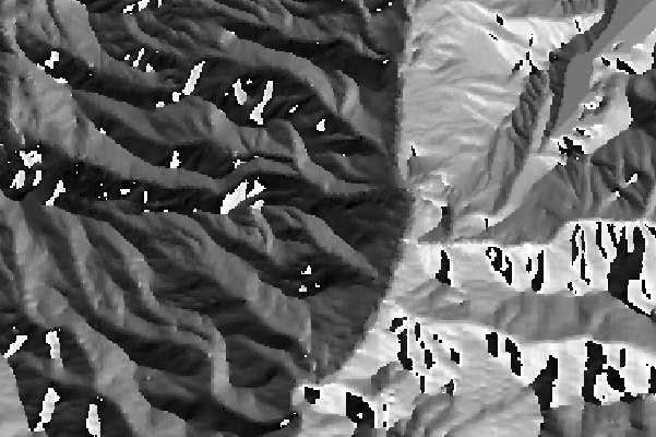
An example of Flow Direction D-infinity output.
ToolBox
implementation
Command line syntax
ETS_GPFlowDirectionDinf
<Input DEM Raster> <Out Flow Direction Raster>
Parameters
| Expression |
Explanation |
| <Input
DEM Raster> |
DEM raster layer or raster dataset |
| <Out Flow Direction
Raster> |
A String
- the full name of the output raster (A raster with the same full
name should not exist). The output raster type depends on the extension
of the output file(see Notes above) |
Examples:
Scripting syntax
ETS_GPFlowDirectionDinf (Input
DEM Raster, Out Flow Direction Raster)
See the explanations above:
<> - required parameter
{} - optional parameter
.NET implementation
(Go to TOP)
FlowDirectionDinf (demRasterDataset As IRasterDataset2,
sOutRaster As String) As IRasterDataset2
Reference:
Tarboton, D. G., (1997), "A New Method for the
Determination of Flow Directions and Contributing Areas in Grid Digital
Elevation Models", Water Resources Research, 33(2): 309-319
| Copyright © Ianko Tchoukanski |