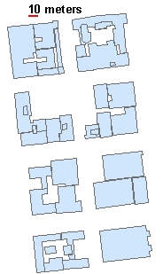
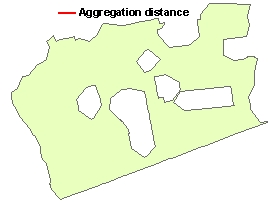
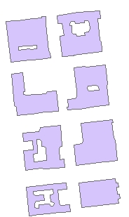
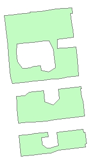
Input Dataset
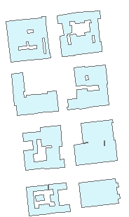
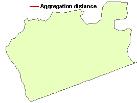
Result (No Minimum area of holes specified)

Go to ET GeoWizards 12.x User Guide
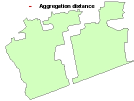
Combines the polygons that are within the user specified distance into new polygons. Can be used also to generalize buildings.
Inputs:
Outputs:
Notes:
Examples:
Input Dataset |
Result (No Minimum area of holes specified) |
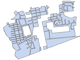
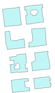
Result (Minimum area of holes specified) |
|
|
|
|
|
|
|
Input Dataset |
Aggregate distance = 1 meter |
Aggregate distance = 5 meters | Aggregate distance = 10 m | Aggregate distance = 20 m |
|
|
|
|
|
|
ToolBox
implementation
(Go to TOP)
Command line syntax
ET_GPAggregatePolygons <input_dataset> <out_feature_class> <Aggregate_tolerance> <area_tolerance>
Parameters
| Expression | Explanation |
|---|---|
| <input_dataset> | A Polyline feature class or feature layer |
| <out_feature_class> | A String - the full name of the output feature class (A feature class with the same full name should not exist) |
| <Aggregate_tolerance> | A Double representing the aggregation distance. The polygons that are closer to each other than this distance will be combined |
| <area_tolerance> | A Double representing the minimum area of holes to be preserved. All holes with area less than this tolerance will be removed. |
Scripting syntax
ET_GPAggregatePolygons (input_dataset, out_feature_class, Aggregate_tolerance,area_tolerance)
See the explanations above:
<> - required parameter
{} - optional parameter
Example Python script:
|
import arcpy arcpy.ImportToolbox("C:/Program Files/ET SpatialTechniques/ET GeoWizards 11.0 for ArcGIS 10.1/ET GeoWizards.tbx") input_dataset = "C:\\data\\pg1.shp" result = "C:\\data\\fgdb_test.gdb\\aggregated" arcpy.gp.toolbox = "C:/Program Files/ET SpatialTechniques/ET GeoWizards 11.0 for ArcGIS 10.1/ET GeoWizards.tbx" arcpy.ET_GPAggregatePolygons(input_dataset, result, 10.00, 1000.00) |
| Copyright © Ianko Tchoukanski |