Go to ET GeoWizards 12.x User Guide
Go to ToolBox
Implementation
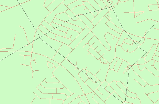
Creates a point feature class with the intersection points of two polyline layers or a
polyline layer and the boundaries of the polygons from a polygon layer.
Inputs:
Outputs:
Notes:
| Sources: A polygon and a polyline datasets |
|
|
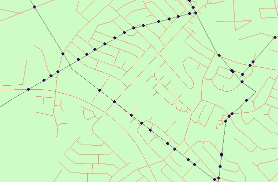
| Resulting points |
|
|
ToolBox
implementation
(Go to TOP)
Command line syntax
ET_GPPointIntersection <input_dataset> <second_dataset> <out_feature class>
Parameters
| Expression | Explanation |
|---|---|
| <input_dataset> | A Polyline feature class or feature layer |
| <second_dataset> | A
Polyline or Polygon feature class or feature class. NOTE: The spatial references of <second_dataset> and the <input_dataset> must have the same Geographic Coordinate System |
| <out_feature class> | A String - the full name of the output feature class (A feature class with the same full name should not exist) |
Scripting syntax
ET_GPPointIntersection (input_dataset, second_dataset, out_feature class)
See the explanations above:
<> - required parameter
{} - optional parameter
| Copyright © Ianko Tchoukanski |