![]()
Go to ET GeoWizards 12.x User Guide
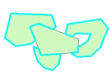
Merges two polygon data sets. The result does not contain overlaps
Inputs:
Outputs:
Examples:
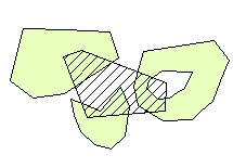
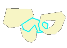
| Input Layers |
|
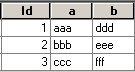
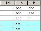
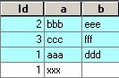
Base layer table
|
| Merge layer table
|
||
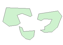
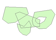
| Result: Priority of "-1" (Erase) |
|
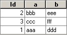
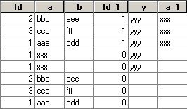
Result table
|
| Result: Priority of "0" (Low) |
|
Result table
|
| Result: Priority of "1" (Standard) |
|
Result table
|
| Result: Priority of "2" (High) |
|
Result table
|
ToolBox
implementation
(Go to TOP)
Command line syntax
ET_GPAdvancedMerge <input_dataset> <merge_dataset> <out_feature class> <merge_priority> {fuzzy_tolerance}
Parameters
| Expression | Explanation |
|---|---|
| <input_dataset> | A Polygon feature class or feature layer |
| <merge_dataset> |
A
Polygon feature class or feature class. NOTE: The spatial references of <merge_dataset> and the <input_dataset> must have the same Geographic Coordinate System |
| <out_feature_class> | A String - the full name of the output feature class (A feature class with the same full name should not exist) |
| <merge_priority> |
Required.
A string representing the priority of the polygons to be merged
|
| {fuzzy_tolerance} | A Double representing the Fuzzy tolerance (in the units of the input dataset) to be used |
Scripting syntax
ET_GPAdvancedMerge (input_dataset, merge_dataset, out_feature class, merge_priority, fuzzy_tolerance)
Example Python script:
|
import arcpy arcpy.ImportToolbox("C:/Program Files/ET SpatialTechniques/ET GeoWizards 11.0 for ArcGIS 10.1/ET GeoWizards.tbx") input_dataset = "C:\\data\\pg1.shp" merge_dataset = "C:\\data\\fgdb_test.gdb\\pg2" result = "C:\\data\\fgdb_test.gdb\\erased" arcpy.gp.toolbox = "C:/Program Files/ET SpatialTechniques/ET GeoWizards 11.0 for ArcGIS 10.1/ET GeoWizards.tbx"); arcpy.ET_GPAdvancedMerge(input_dataset, merge_datase, result, "Erase", "0.003426878") |
| Copyright © Ianko Tchoukanski |