Go to ET GeoWizards 12.x User Guide
Delineates cluster polygon for the input points based on user specified cluster distance.
Inputs:
Outputs:
Examples:
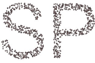
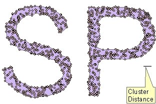
| Source Points | |
|
|
|
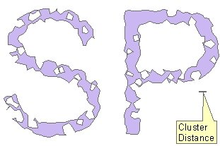
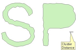
| Cluster Polygons 1 | Cluster Polygons 1 overlaid with the source points |
|
|
|
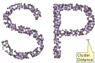
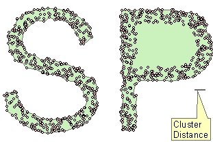
| Cluster Polygons 2 | Cluster Polygons 2 overlaid with the source points |
|
|
|
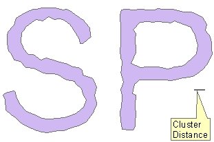
| Cluster Polygons 3 (No Holes option selected) | Cluster Polygons 3 overlaid with the source points |
|
|
|
ToolBox
implementation
(Go to TOP)
Command line syntax
ET_GPCreateClusterPolygons<input_dataset> <out_feature class> <cluster_distance><remove_holes_from_polygons>
Parameters
| Expression | Explanation |
|---|---|
| <input_dataset> | A Point, Multipoint, Polyline or Polygon feature class or feature layer |
| <out_feature class> | A String - the full name of the output feature class (A feature class with the same full name should not exist) |
| <cluster_distance> | A Double representing the maximum distance between the points within a cluster - in the units of the spatial reference of the input dataset |
| <remove_holes_from_polygons> | A Boolean - If true, the resulting polygons will not contain holes. |
Scripting syntax
ET_GPCreateClusterPolygons(input_dataset,out_feature class, cluster_distance, remove_holes_from_polygons)
See the explanations above:
<> - required parameter
{} - optional parameter
Example Python script:
|
import arcpy arcpy.ImportToolbox("C:/Program Files/ET SpatialTechniques/ET GeoWizards 11.0 for ArcGIS 10.1/ET GeoWizards.tbx") input_dataset = "C:\\data\\pg1.shp" result = "C:\\data\\fgdb_test.gdb\\clusters" arcpy.gp.toolbox = "C:/Program Files/ET SpatialTechniques/ET GeoWizards 11.0 for ArcGIS 10.1/ET GeoWizards.tbx"); arcpy.gp.ET_GPCreateClusterPolygons(input_dataset, result, 10.00, true) |
| Copyright © Ianko Tchoukanski |