Go to ET GeoWizards 12.x User Guide
The Concave Hull function creates a polygon that represents the area occupied by a set of data points.
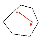
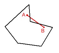
The resulting polygon might be concave or convex
| Convex | Non Convex (Concave) |
|
|
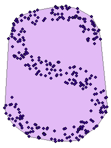
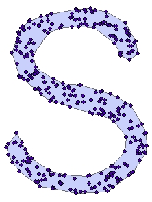
A Concave hull describes better the shape of the point cloud than the convex hull
| Convex Hull | Concave Hull |
 |
 |
Many solutions are possible for the same input data. The result depends on the user defined distance threshold. The larger the threshold, the closer the resulting polygon will be to the Convex Hull.
| Source Data | Convex Hull |
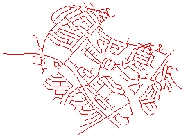 |
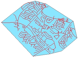 |
| Concave Hull 1 | Concave Hull 2 |
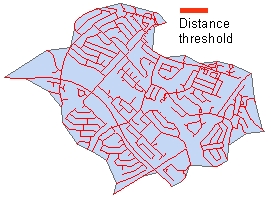 |
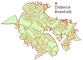 |
Inputs:
Outputs:
ToolBox
implementation
(Go to TOP)
Command line syntax
ET_GPCreateConcaveHull <input_dataset> <out_feature class> <distance_threshold>
Parameters
| Expression | Explanation |
|---|---|
| <input_dataset> | A Point, Multipoint, Polyline or Polygon feature class or feature layer |
| <out_feature class> | A String - the full name of the output feature class (A feature class with the same full name should not exist) |
| <distance_threshold> | A Double representing the threshold for creating a concave hull - in the units of the spatial reference of the input dataset |
Scripting syntax
ET_GPConvexHull (input_dataset,out_feature class, distance_threshold)
See the explanations above:
<> - required parameter
{} - optional parameter
| Copyright © Ianko Tchoukanski |