Go to ET GeoWizards 12.x User Guide
Builds the Convex Hull of the features of a layer
Convex hull is a polygonal area that is of smallest length and so that any pair of points within the area have the line segment between them contained entirely inside the area.
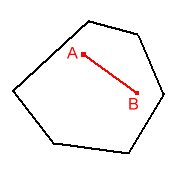
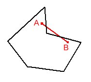
| Convex | Non Convex (Concave) |
|
|
Defining the convex Hull of a set of points is useful, for example in the case of enclosing the points, using a fence of shortest total length.
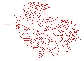
| Source Data | Convex Hull |
 |
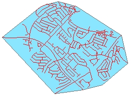 |
While in general the Convex Hull is good to describe the shape of the input data points, in many cases a polygon that describes better the region occupied by the point cloud is needed. See the Create Concave Hull function
| Convex Hull | Concave Hull |
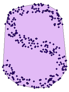 |
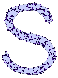 |
Inputs:
Outputs:
ToolBox
implementation
(Go to TOP)
Command line syntax
ET_GPConvexHull <input_dataset> <out_feature class>
Parameters
| Expression | Explanation |
|---|---|
| <input_dataset> | A Point, Polyline or Polygon feature class or feature layer |
| <out_feature class> | A String - the full name of the output feature class (A feature class with the same full name should not exist) |
Scripting syntax
ET_GPConvexHull (input_dataset,out_feature class)
See the explanations above:
<> - required parameter
{} - optional parameter
| Copyright © Ianko Tchoukanski |