Input Dataset
Result Dataset

Go to ET GeoWizards 12.x User Guide
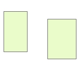
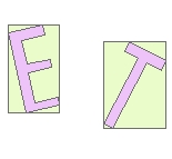
Creates a polygon from the envelope of each feature in the input feature class. Attributes of the original features are transferred to the envelope polygons.
Inputs:
Outputs:
Examples:
Input Dataset |
Result Dataset |
Overlay |
|
|
|
|
 |
ToolBox
implementation
(Go to TOP)
Command line syntax
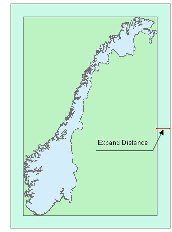
ET_GPFeaturesToEnvelopes<input_dataset> <out_feature class> {Expand_Distance}
Parameters
| Expression | Explanation |
|---|---|
| <input_dataset> | A Polyline, Polygon or Multipoint feature class or feature layer |
| <out_feature_ class> | A String - the full name of the output feature class (A feature class with the same full name should not exist) |
| {Expand_Distance} | A double - distance in the units of the spatial reference of the input dataset with which the envelope of each feature will be expanded. The parameter is optional. The default value is 0 - no expand |
Scripting syntax
ET_GPFeaturesToEnvelopes (input_dataset, out_feature_ class, Expand_Distance )
See the explanations above:
<> - required parameter
{} - optional parameter
| Copyright © Ianko Tchoukanski |