Near Dataset - Polylines
Near Dataset - Polygons
Near Dataset - Polylines
Go to ET GeoWizards 12.x User Guide
Calculates the distance for each feature of the Input dataset to the closest feature from the Near dataset. In the attribute table of the output the distance is recorded together with the ID of the closest feature.
Inputs:
Outputs:
Notes:
Examples:
|
|
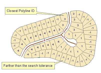
Input Dataset - Polygons Near Dataset - Polylines |
|
|
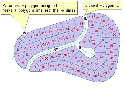
Input Dataset - Polylines Near Dataset - Polygons |
|
|
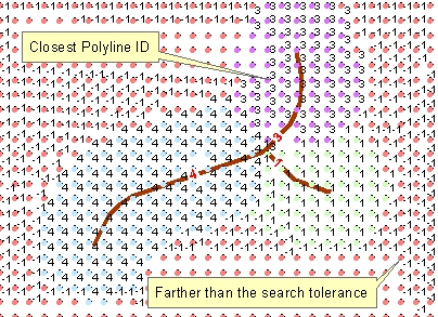
Input Dataset - Points Near Dataset - Polylines |
ToolBox
implementation
(Go to TOP)
Command line syntax
ET_GPNearFeature<input_dataset> <Near_dataset> <out_feature_class> <search_tolerance>
Parameters
| Expression | Explanation |
|---|---|
| <input_dataset> | A Point, Multipoint, Polyline or Polygon feature class or feature layer. |
| <Near_dataset> | A Point, Multipoint, Polyline or Polygon feature class or feature layer. |
| <out_feature_class> | A String - the full name of the output feature class (A feature class with the same full name should not exist) |
| <search_tolerance> | A Double representing the Search tolerance (in the units of the spatial reference of the input dataset) to be used |
Scripting syntax
ET_GPNearFeature(input_dataset, Near_dataset, out_feature_class, search_tolerance)
See the explanations above:
<> - required parameter
{} - optional parameter