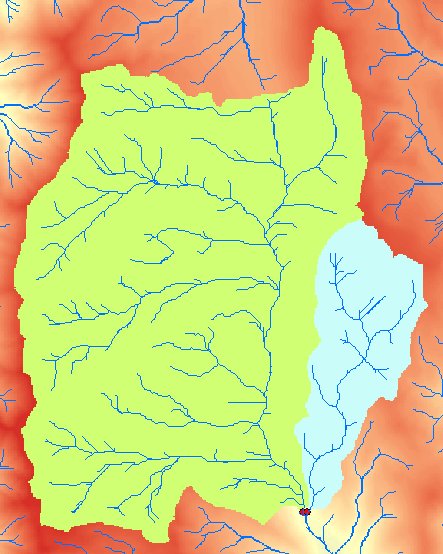
Delineates Watersheds (Drainage basins) from a D8 Flow Direction raster for a set of Outlet points.
An example of Watershed output using Outlet points.
Parameters
| Expression | Explanation |
|---|---|
| Function Name | Watershed |
| <input raster> | A String representing the input D8 Flow Direction Raster. |
| <output raster> | A String - the full name of the output raster. |
| {OutletPoints} | A String - the full path to a point layer with the Outlet points. |
| {OutletIDField} | A String - the name of an Integer Field in the Outlet Point layer with values to be assigned to the delineated Watersheds. |
ETSPath used in the table below is the full path to ETSRun.exe (E.G. "C:\Program Files\ETSpatial Techniques\ETSurface\ETSRun.exe")
| Language | Syntax |
|---|---|
| Python | subprocess.call([ETSPath, "Watershed", "input raster", "output raster", "OutletPoints", "OutletIDField"]) |
| .NET using ETSRun.exe | StartInfo.FileName = ETSPath StartInfo.Arguments = "Watershed" "input raster" "output raster" "OutletPoints" "OutletIDField" |
| .NET using ETSOutX.dll | Watershed(input raster, output raster, OutletPoints, OutletIDField) |
| ArcPy | arcpy.Watershed("input raster", "output raster", "OutletPoints", "OutletIDField") |
Notes: