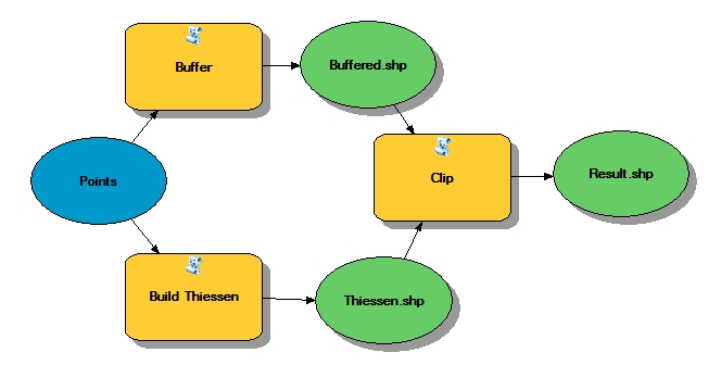
Create non-overlapping buffers with attributes for points
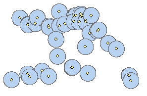
Very often we need to buffer some features and get the attributes from the original features. "But this is pretty
easy" many people will say - "it is a standard tool in any GIS software" - and they will be correct... Unless the buffers of the
features do overlap each other which in many cases is undesirable.
In this article we will offer an approach of
creating non-overlapping buffers (one polygon per original feature) that will carry the attributes of the original features.
In this article used only functions available in ET GeoWizards 12.0
The question that we have to answer is how to partition the buffers created in this fashion so that each original feature gets its own buffer polygon.
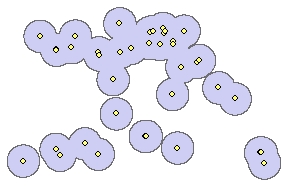
STEP 2: We can use the Build
Thiessen Polygons function to separate the space of the original dataset in such a way that a polygon (area of influence) is assigned
to each original feature.
In order to make sure that the Thiessen polygons cover the entire extent of the buffered polygons created in STEP 1:
- use the option for creating Thiessen polygons with the buffered convex hull
- Use a buffer distance larger than the distance used for buffering.
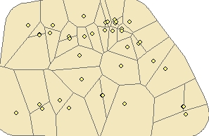
Now we need to find a way to split the buffers for all points created in STEP 1. with the Thiessen polygons and each original point will have its own buffer polygon.

STEP 4: We can use the Clip function to clip the Thiessen Polygons with the buffers created in STEP 1
Sample Model of the entire process (ArcGIS Desktop and ArcGIS Pro only)